It has been a while since the 2018 SUPERACE is over, I still look at the photos taken during the race from time to time. My thoughts have returned to crossing the borders by running, the scenery along the run. I can’t forget how heart-touching it was when I finished the race.
In recent years, I have finished a few medium and long distance cross country and ultramarathon races locally and abroad (2015 Qixing Mountain Trail Running Challenge 43K, 2016 Nanheng Ultramarathon 60K, 2016 Charming Yilan Trail 50K, 2016 Action Asia AAE50, 2017 Run Through the Jungle 34K, 2017 Nanheng Ultramarathon 100K, 2017 KOREA 50K, 2017 Charming Yilan Trail 24K, 2017 MSIG Hong Kong Lantau 50K). I gained a decent amount of competition experience, but I have not yet run B2B (back to back) for a multiple-day race. Not to say to run for consecutive 2 days bearing weights for a longer than regular marathon distance, I feel a bit nervous.
Why did I carelessly fall into the trap of a multi-day race? This dated back to April 2017 the KOREA 50K race in Korea. After I inspect my equipment at the venue 1 day before the race, suddenly I heard familiar Taiwanese-Mandarin. I turned my head around, and saw 2 girls bring the champion team - 3 idiots - of the SUPERACE Taiwan Ultramarathon that year. A group of people around chatting. I went over for a chatter, and learnt that they are the organizing team of the SUEPRACE Ultramarathon. Actually, I have saw the SUPERACE events at the registration website before, but I always feel that level of competition is very far away from me. After I completed KOREA 50, I verbally agreed to participate in the 2018 Taiwan Ultramarathon in a half joking tone.

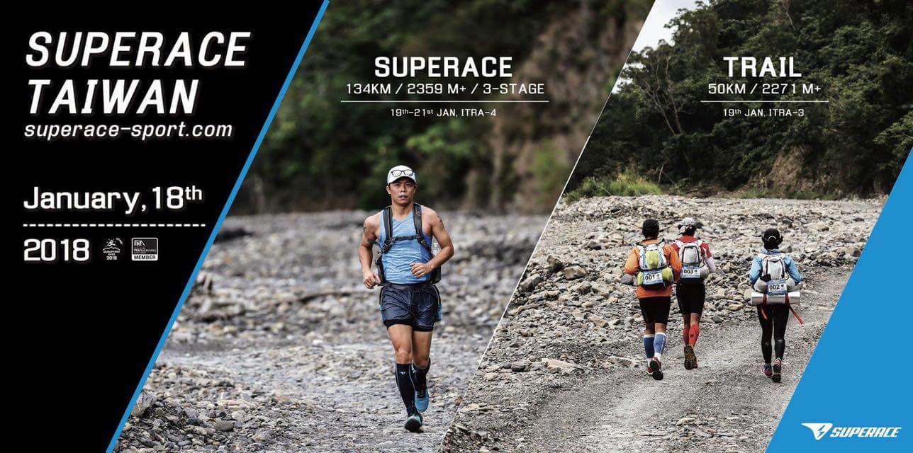
2017 / JAN / 19 DAY 1
【Start】Lili Elementary School → Dahan Forest Trail 6K marker → Jinshuiying Historical Trail → Kalapang → Daren Township → Lower Nantian Village【Camp Site】
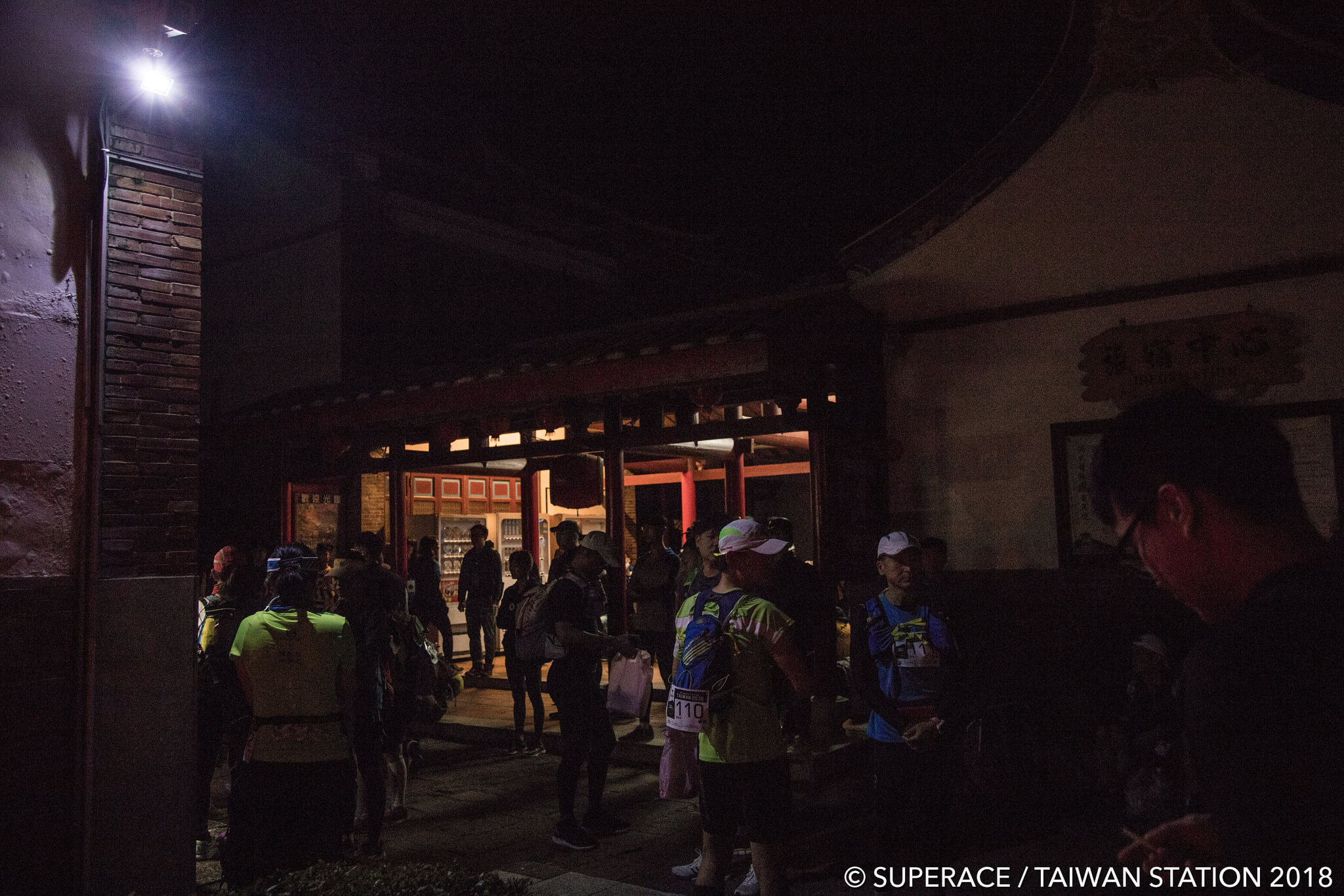
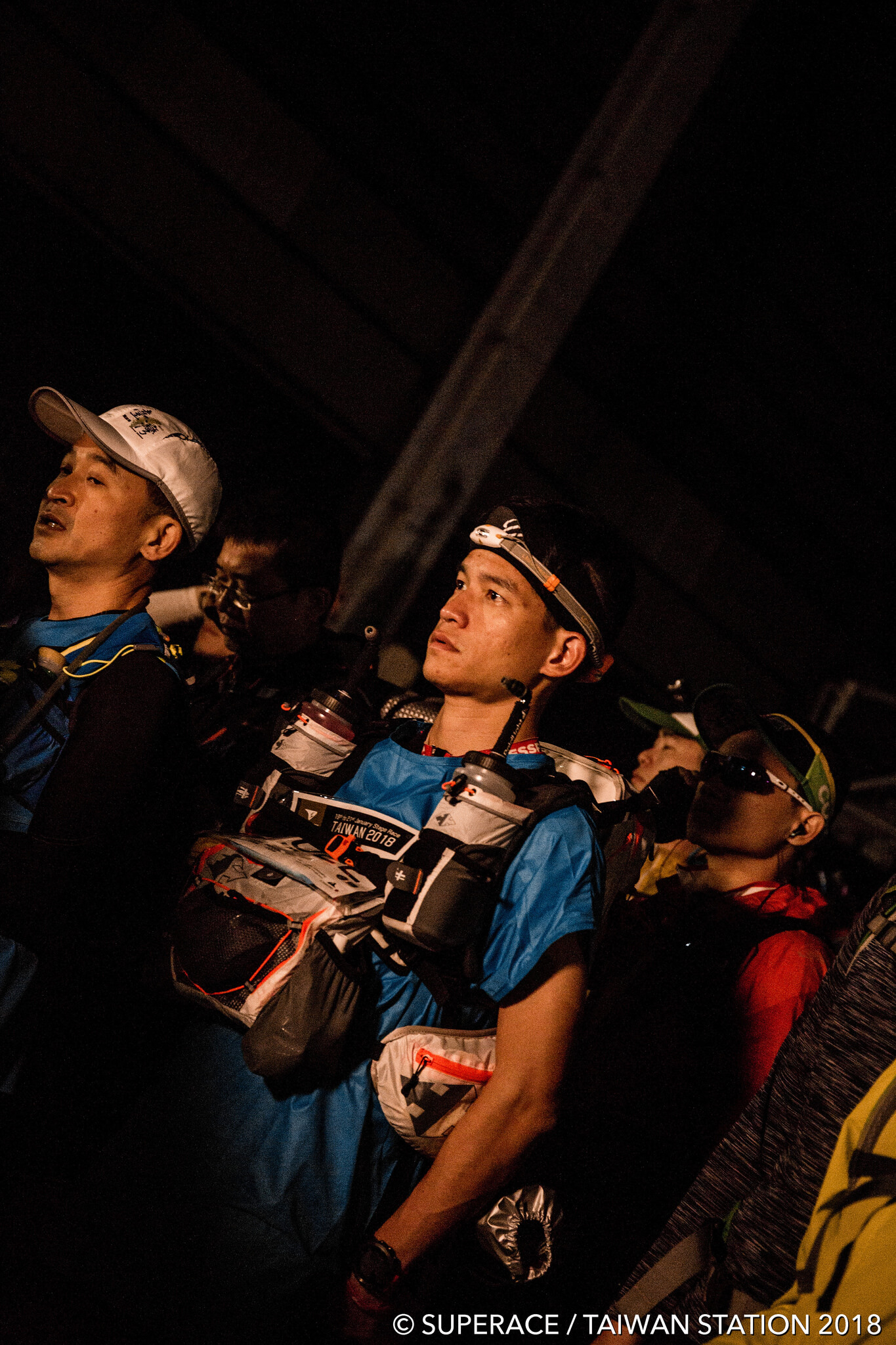
I slept like a dead on the shuttle bus. A fellow runner on my side woke me up. the bus arrived at the Chunri Township. A blast of cold wind and fine rain received us outside the bus. I thought, my gosh… to run light, I wore only a surgical-gown like short-sleeved waterproof jacket. If it rains heavily, it would not withstand. To warm my body up quickly, I ran 2-3 laps on the primary school playground. A few minutes after taking the group photo the race would start. With a disturbed mind, I waited for the count down and faced the next 3 days of unknowns. I thought, I have travelled a long way from one side of Taiwan to another; if I would give up on the first day of race, because of losing body temperature, I would hate the world. I could only pray God to give us a suitable weather to enjoy the next 3 days of run.
The first checkpoint (CP), personal coaches were waiting for athletes to pass by and to help them replenishing water. The weather was cool, and the 2 bottles I carried still had some 1.2L of water. I signaled no water replenishment, and continued the 23.5K journey towards the second CP. Following is the Dahan Forest Road, a cement section. It is an uphill road with curves. After running alone for 40 min, I saw the back of a runner ahead on an uphill. I thought, having an accompany to run and to talk would be less boring. In the chat, I found out Chun Da is local young guy from Pingtung, who participated in this race for the second time. He joined also the Sahara Desert 250K multi-day race! After running and chatting along for about 20K, we separated to move forward in our own speed; Next, I saw a 23.5K road side on an uphill, finally arriving the second CP. This is the entrance of the Jinshuiying Historic Trail. I stayed for 3 min. I asked the staff to help me refilling-up my water bottles, and to take a souvenir photo with the Trail standing sign. Now I formally entered the famous Jinshuiying Historic Trail!
The distance between the Trail standing sign and its formal entrance was about 400m. I ran upward, turned right, and saw immediately a mist slowly drifting into the Trail. This resembles the travel notes I have read. It is true. The trail is humid and misty throughout the year, covering by a rich variety of plants. Arriving at the entrance of the Trail. It was written that the trail is 16 km long, and takes about 6 hours to walk. The elevation chart marked that here is the highest point, close to 1500m above sea level. From here to the end of the Trail, Gu-alun Bridge was all downhill, my favourite. My watched showed it was at 9:30. Let me see if I can reach the end of the trail within 2 hours to CP3. 3.5 hours was over since the start of the race, having run almost 24 km, with an accumulated latitude of over 1000m. My speed was acceptable.
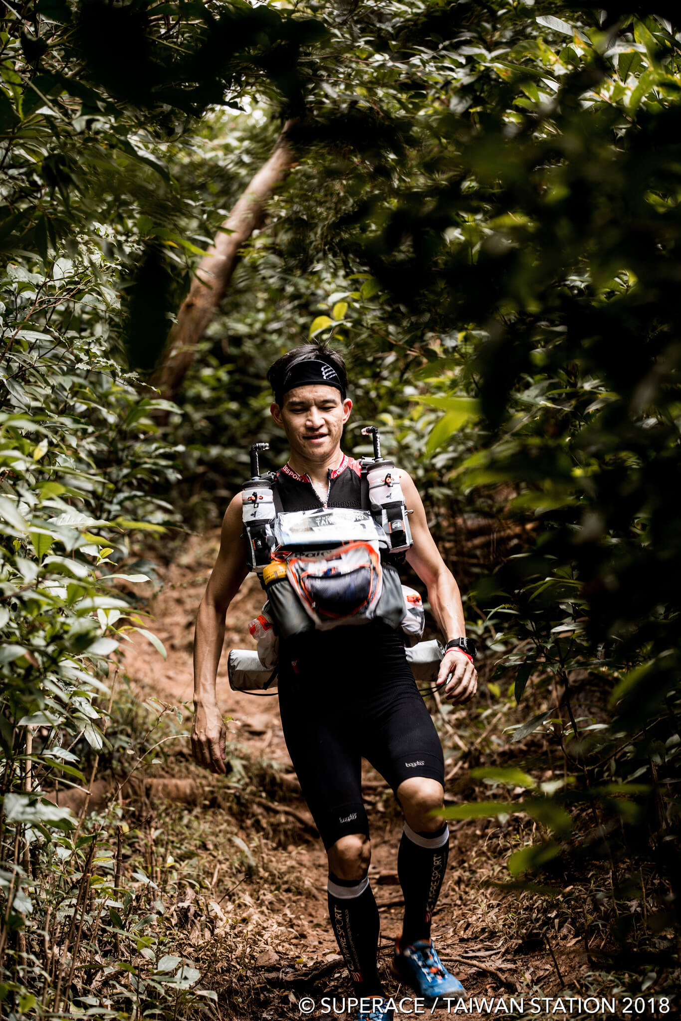
The Trail was misty and quiet. I was alone all the way with the nature. Once in a while I heard some unknown little animals being scared off by me. I enjoyed very much the run on the Trail downhill, with my movement in accord with the terrain, and concentration in focusing to locate the next point of step. Because the Trail is misty and humid throughout the year, 90% of the trail was slippery, but not yet muddy. There was a rich variety of plants on the trail. It was a natural forest, without many man-made stone routes. Occasionally with some explanation signs for the historical remains. I took a big breath of fresh air rich in anions and moved forward, while noticing the distance mark at the side of the road was going down. Whenever I felt hungry, I run slower and ate an energy bar. On the one hand, I felt a bit lonely on this trail without people; on the other hand, I enjoyed my peaceful independence in a temporary isolated world.
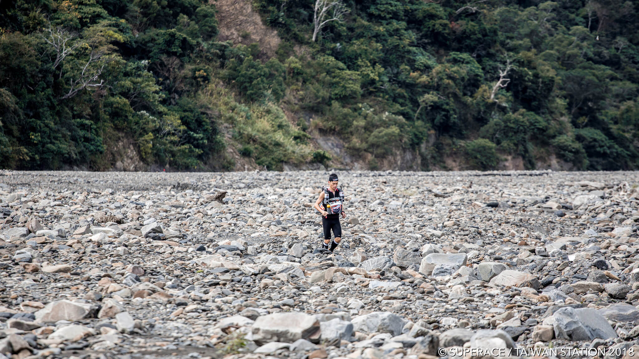
After arriving CP3, I saw a skillful runner taking a rest. Might be my arrival made him alert, he quickly packed and left. But all I wanted was only to have a cup noodle and some warm soup. After my meal, I thanked the volunteers and continued my journey. Waiting for me was the dried Da-wu Riverbed. This river bed was full of gravels. The stream flew slowly. The scenery was rather similar to arriving in Mars. I was like an astronaut carrying equipment on an exploration. The scenery around gave a sense of desolation and loneliness.
After leaving the riverbed, I arrived at the last CP located at the Qaljapang, with an accumulated distance of 41km. I refilled water and immediately continued my journey. The Provincial Highway 9 was a flat segment. On the left is the Pacific Ocean. It was cool to have a seaview under the sun. However, an endless long road might make people feel there is no ending. A while passed, looking at the ribbon sign along the road. I only felt the destination was far far away. I located myself with my mobile GPS. There should be less than 1km until the destination, lower NantianVillage. From far away, I heard volunteers screaming and cheering that I would soon arrive. I barely squeezed out a smile, dashing to the finish. The first day with 55 km has finally ended.
The organising unit has prepared tents for everyone. NPUST students helped athletes to massage and treat injuries. A huge thank to them. This night, after I had a cup noodle and instant rice, I slept early. Under the sound of waves, we fell asleep.

SHARE TO FRIENDS
tell them about SUPERACE